HAZMAT MAPPING
Push critical HAZMAT data to those that need it and increase the effectiveness of all your command and emergency response systems that utilize your mapping layers.
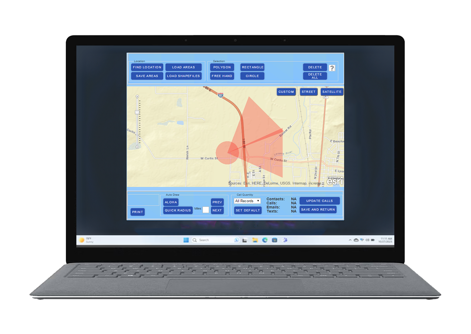
GIS MAPS / Dispatch-CAD / Reverse 911
Our PEAC HAZMAT facility map layers create instant awareness of HAZMAT threats and can interactively ‘reach-back’ to our PEAC system giving your teams all the information they need to respond safely and even alert the public. Let us show you how we can create a custom HAZMAT map layer to integrate with your GIS-related systems today.
GIS HAZMAT FACILITY MAP LAYERS
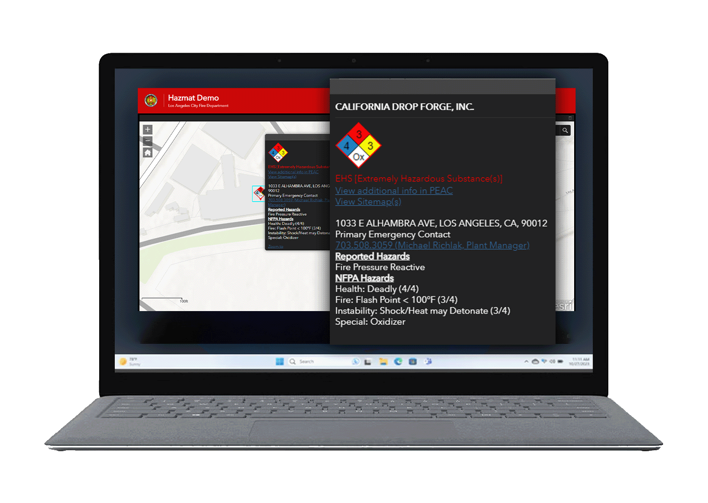
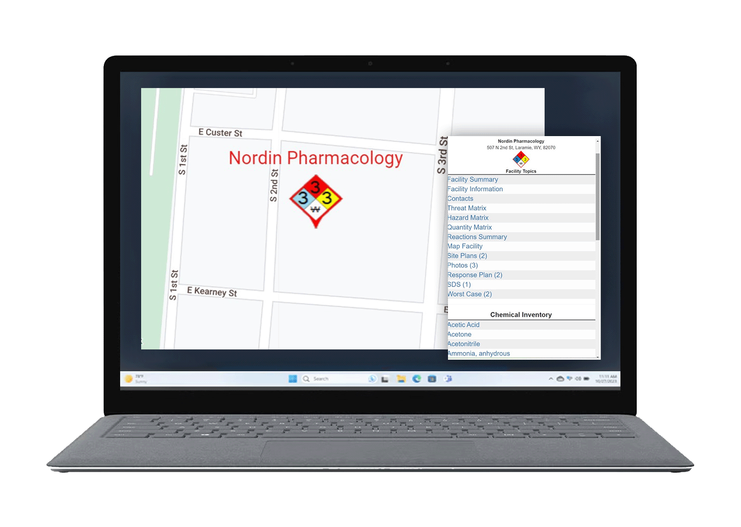
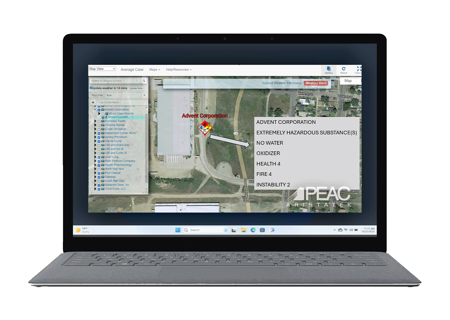
Our NFPA placard symbology is universally recognized by responders during HAZMAT emergencies. With a single click, users can access emergency contact information, chemical hazard details, and more based on your facility’s Tier II / CERS (CA) data.

DISPATCH & CAD ENHANCEMENT
Timely information is critical during a high-consequence HAZMAT emergency. There may be no more effective way to disseminate HAZMAT information than by utilizing your dispatcher and computer-aided dispatch system. Whether using PEAC software at call center workstations for text-based systems or having us design a custom map layer for integration into your next-gen 911 computer-aided dispatch (CAD), we’ve got you covered.
ALERTING USING REVERSE 911
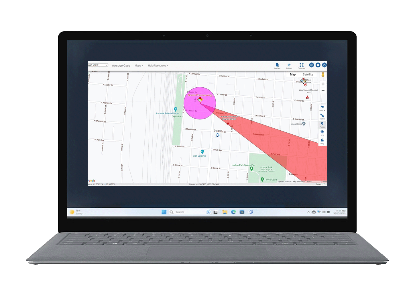
Alerting the public with shelter-in-place or evacuation orders during a HAZMAT emergency is crucial to public safety. Our proprietary PEAC facility worst-case hazard analysis can generate outputs that help you identify who to alert in advance, saving critical time. We offer alerting outputs such as ‘affected public’ distance spreadsheets or map layers with shapefiles, ready to import directly into your Reverse 911 system. Discover how we can enhance your Reverse 911 system today.